

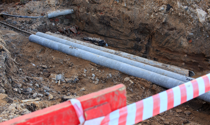
Underground utility mapping is a process that helps to map out the various underground utilities in a specific area. This process is essential in order to avoid any physical harm to these sensitive components. Utility mapping provides a great deal of precision and understanding in order to detect these components, and as a result, it is growing in popularity among government agencies and local municipalities. The importance of utility mapping becomes especially clear in industries such as geophysics, environmental engineering, and infrastructure development. In these fields, a precise understanding of the underground landscape is essential, and utility mapping provides the necessary information.
Organizations that are looking to avoid expensive and time-consuming excavation projects can benefit from subsurface utility mapping services. These services use cutting-edge technology to identify the location and depth of essential subsurface infrastructure, such as gas lines and concrete foundations. This information is then plotted and communicated to relevant parties, so that crews can avoid damaging these vital infrastructure components. With accurate and up-to-date information about what is beneath the surface, organizations can save time, money, and energy on their excavation projects according to Ireland GPR surveys company precision-um.ie.
Here are Three of The most Significant Benefits of Underground Utility Mapping Services:
1) Save money
A utility service of mapping is an important tool for any business that relies on subterranean property, such as water or gas lines. With centralised database access, a utility service of mapping can help improve work efficiency and save long-term financial gain. Reliable and accurate information can be sent to the field crew from a remote location, thus eliminating the need for developing prints, preparing manual reports, checking daily schedules, and much more. Additionally, this service helps reduce overhead costs related to preventive repairs and maintenance.
2) Manage and monitor assets easier
Utility locating mapping is an essential tool for public works agencies. It helps professionals on the ground to retrieve specific information about repairs, maintenance, and inspection. Equipped with a tracking device that uses location, one can trace position data and share it in a timely and precise manner. This real-time information enhances decision-making and job precision while also lowering the cost of maintenance and replacement services. Without question, utility locating mapping is an important asset management tool that can help public works agencies improve their efficiency and effectiveness.
3) Improve decision making
One of the primary advantages of this service is its capacity to provide precise visualization through utility mapping. Finally, it is now simple to combine regular road maps and aerial photographs alongside essential property data like permits, zoning, and developments. Staff can provide more useful and accurate information for official city meetings by focusing exclusively on the most important factors. As a result, the issue is better understood, which facilitates making decisions more quickly. This benefit is extremely important because it allows city officials to make better decisions in a prompt manner. Without this capability, city officials would have to sift through large amounts of data that are not relevant to the task at hand, wasting time and resources.


Commented Posts